Now that you’ve got a map, you need to be able to print it or to export it to a document. Luckily, QGIS can export its map file to a format that anyone’s computer can read, as well as printing out the map if you have a printer connected. Both exporting and printing is handled via the Print Layout.
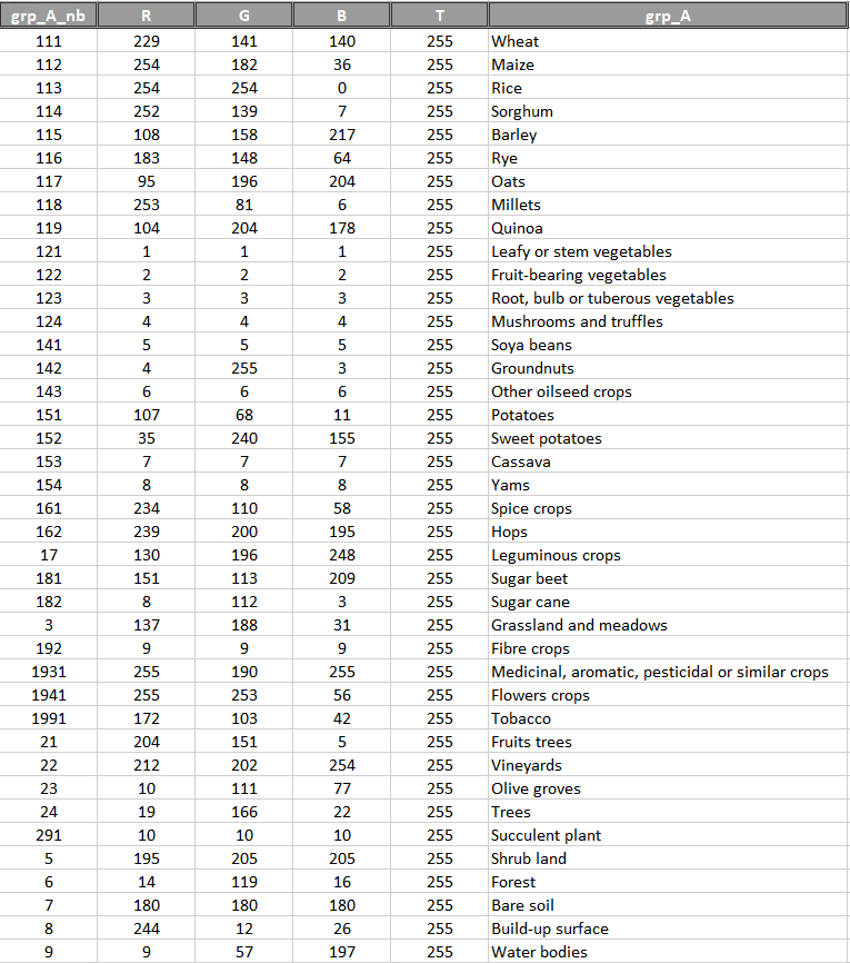
If the classification has many classes, it may be useful to create a Color Map file to easily draw a legend to the classification with the right colours and labels.
